
Kasol and Tirthan
Kasol, Parvati and Tirthan valley trip guide
Two valleys leave the Kullu to Manali road. Parvati rises east from Bhuntar, at the confluence of the Parvati and the Beas, and goes up to 5,000 m. Tirthan is the park's buffer zone, about 70 km from Kullu. Both are reached from Bhuntar airport, 10 km from Kullu and 50 km from Manali on the Kullu district how-to-reach page, and from the Aut turn on the Chandigarh to Manali highway.
Sourced 14 Nov 2026. Great Himalayan National Park official pages last updated 10 September 2026. Wildlife Wing closure memos 5 Mar 2025 and 28 Mar 2026. Kullu district tourist places 24 Apr 2018, Manikaran 26 Apr 2018, how to reach 28 May 2019. Incredible India Kullu and GHNP pages undated, read 14 Nov 2026.
The two valleys
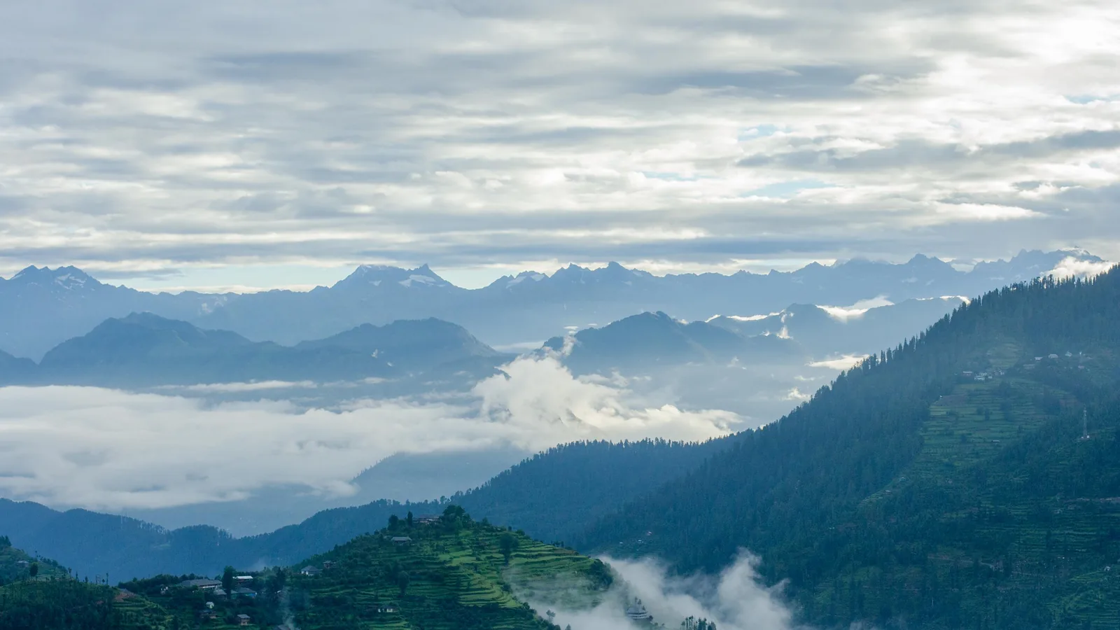
The park home page (10 Sep 2026): the Parvati Valley rises eastwards from the confluence of the Parvati and Beas Rivers at Bhuntar in Kullu District and goes up to 5,000 m. The Parvati Valley page says the valley can be accessed from Bhuntar, a short drive from the Kullu-Manali Airport, and that part of the valley lies close to the Great Himalayan National Park. Tirthan, on its own destination page, sits in the eco-rich buffer zone, about 70 km from Kullu.
Parvati valley places
As the park site prints them. The Kullu district tourist places list (24 Apr 2018) names only Manikaran and Manali in this belt. There is no district page for Kasol, Tosh or Kheerganga, and no official distance for Kasol.
- Kasol: the park Parvati page, in its own words: often dubbed "Mini Israel," this lively riverside village is known for its fusion of cultures, cozy cafés, and music-filled nights. That is the park site's line. This guide does not name cafés or hotels.
- Manikaran: 1,829 m and 40 km from Kullu on the district Manikaran page (26 Apr 2018), with the finest hot water springs at the entrance to the village. Rice can be cooked if placed in a muslin bag and thrown into the hot water pool. Because of Raghunathjee and the Gurudwara, it is a favourite of Hindu and Sikh pilgrims. Incredible India's Kullu page names the Gurudwara Manikaran Sahib and the ancient temples, and says the hot springs are believed to have healing properties. Bathing rules and gurdwara timings are not printed.
- Tosh and Kalga: quiet hilltop villages with panoramic views, on the park Parvati page. No official distances.
- Rudranag and Nakthan: short scenic trails for day hikes or overnight camping, on the same page.
Kheerganga and Pin Parvati
The park Parvati page: Kheerganga Trek, known for its hot spring at the summit and a forest-lined trail. Distance, altitude, permit and fee are not on a readable official page. Check with the Kullu forest division. The park introduction (10 Sep 2026): in 2010, the Parvati River catchment (710 km²) to the park's north was declared Khirganga National Park.
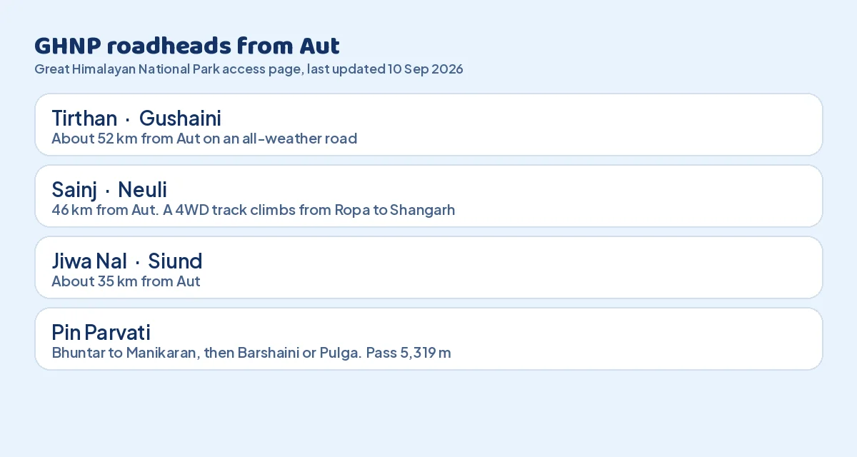
Pin Parvati is for seasoned hikers, connecting to the Spiti region. The access page: after Aut, follow NH21 up to Bhuntar, then the link road to Manikaran and up to Barshaini. Begin from Barshaini or from Pulga, which has an old forest rest house. The trek ascends to Mantalai and the Pin Parvati Pass (5,319 m). The fees page adds that some treks, for example over that pass, are very strenuous and need excellent health, trekking experience, mountaineering, snow-walking and orientation skills. For the Spiti side after the pass, see the Spiti Valley trip guide.
The Great Himalayan National Park
Constituted in 1984 and formally notified as a national park in 1999, in Banjaar sub-division of Kullu District. UNESCO World Heritage Site on 23 June 2014. The park facts page (10 Sep 2026): 31 mammal species, 209 bird species, 832 plant species. A little over half of GHNP lies above 4,000 m. Four mammal species and three bird species are globally threatened, including the musk deer and the western horned tragopan. The upper forest zone holds the world's largest known population of the western tragopan.
The park introduction prints the park area as 754.4 km², an ecozone of 265.6 km² with around 2,300 households across 160 villages, Sainj Wildlife Sanctuary 90 km² around Shagwar, Shakti and Maror, and Tirthan Wildlife Sanctuary 61 km² on the southern edge. Incredible India's GHNP page prints 1,171 square kilometres and 1,500 to 6,000 meters. Travelers will see both figures: 754.4 km² on the park site, 1,171 square kilometres on Incredible India.
The access page puts the lowest altitude at 1,700 m, rising to 5,800 m at the highest peak (10 Sep 2026). The weather page says 1,500 m to over 6,000 m. This guide uses the access-page band and notes the weather page's wider range.
Getting into the park
From the fees, rules and guidelines page (10 Sep 2026). Entrance is by permit, with additional charges for still and video cameras. Permits for the core zone can be obtained at the head office in Shamshi and the range offices in Shairopa (Tirthan Valley) and Ropa (Sainj Valley). The page says: please check with the park authorities for latest fees. This guide prints none. Entry is not allowed without prior permission. Trekking routes must be discussed with and approved by a GHNP range officer. Some areas are out of bounds.
- On foot only: there is no provision for motor safaris.
- Guides: multi-day trekkers must engage certified guides and porters.
- Insurance: visitors of more than one day are strongly advised to buy travel insurance that covers emergency medical treatment and evacuation.
- Health: if you are in good health, you should easily be able to trek up to 4,000 m.
- Conduct: no picking of plants, keep noise down, carry out non-biodegradable litter, latrine pits 100 m from water, no green wood for fires. Modest attire at all times.
- Forbidden: smoking and kindling of fires except for cooking; damage to or removal of wildlife, trees, plants or signs.
- Booking: forest rest houses and trek permits are booked through the official site's Book Your Stay login (Accommodation and Trek Permits tabs). No tariffs are printed.
For which ID a forest gate may accept, see the travel ID checker. For whether GHNP trek routes are in season on your date, including the May stretch, use the national park season checker.
Roadheads and treks
The town of Aut, on the Chandigarh to Manali highway, is the main access point. Routes: Aut to Larji Dam to Shai Ropa to Gushaini, and Aut to Larji Dam to Sainj to Siund.
- Tirthan: Gushaini, about 52 km from Aut on an all-weather road.
- Sainj: Neuli, 46 km from Aut. About 5 km short of Neuli is Ropa, from where a gravel road climbs to Shangarh, suitable only for four-wheel-drive vehicles.
- Jiwa Nal: Siund village, about 35 km from Aut.
| Trek | Days | Length and notes | Source, 10 Sep 2026 |
|---|---|---|---|
| Tirath | 7 days, moderate to strenuous | Gushaini 1,500 m to Rolla 2,100 m, Nada Thach 3,300 m, Tirath 4,000 m. Glacial lake, sacred to locals | Tirath trek |
| Gushaini to Rakhundi Top | 5 days | 56 km round trip. Rolla to Shilt Hut 3,100 m | Rakhundi trek |
| Morahani | 5 days | Tirthan valley | Morahani trek |
| Neuli to Homkhani | 5 days, moderate | 56 km round trip. The park page calls this perfect for beginners | Homkhani trek |
| Raktisar | 7 days | 92 km, Sainj valley | Raktisar trek |
| Shreekhand Mahadev | 9 days | About 100 km round trip. Shivling about 5,227 m on the trek page. The Banjar page prints Srikhand peak 5,139 m | Shreekhand trek |
Seasons
From the season page and weather page (10 Sep 2026). The park is open for most of the year. In winter some areas are inaccessible due to snow. Most trekking routes remain closed for the winter, December to March, and at other times when there is snowfall. Core-zone trekking is best from April to June and again from September to November. Pin Parvati follows a similar pattern. Birding is best March to June and September to November. Pheasant-watching is particularly recommended from March to May and October to November. Trout fishing in designated eco-zones is best from April through October. Local fairs are most vibrant from March to June. Camping and sightseeing have optimal conditions between March and November.
- Spring, March to May: day temperatures 12 C to 20 C.
- Summer, June to August: temperatures often reaching 25 C in the lower areas. This is also the monsoon.
- Autumn, September to November: considered the best time to visit. Daytime 10 C to 18 C.
- Winter, December to February: heavy snowfall in higher zones. Roads usually deteriorate in the monsoon and winter.
- Rain and extremes, climate page: rainfall especially between mid-June and mid-September, up to 1,298 mm. Up to 40 C in June at lower altitudes, minus 10 C or lower in January higher up.
The Rolla to Rakhundi to Ghumtaro stretch has been closed every May in 2025 and 2026 for the Western Tragopan breeding season. The 2025 Wildlife Wing memo (WL/4669 of 5 Mar 2025) closed Rolla-Shilt-Chhodwar-Rakhundi to Ghumtarao from 1 May 2025 to 31 May 2025. The 2026 memo (WL/CZA/5912 of 28 Mar 2026) closed the same stretch from 1 May 2026 to 31 May 2026. Expect the same in May 2027 and check the park site.
Tirthan, Sainj, Banjar and Larji
The Tirthan Valley page (10 Sep 2026): named after a sacred spring called Tirth which originates at Hanskund Peak (4,800 m). After 70 km from the source it joins Palchan Nallah at Gushaini. Tirthan and Sainj merge with the Beas at Larji. The page says the valley covers 754 sq km and constitutes Tirthan Wildlife Sanctuary and part of GHNP, the same figure as the park area, so treat it as the valley's catchment. A second Tirthan page calls the Tirthan stream famous for trout, and Gushaini the meeting of the Tirthan and Palchan.
- Sainj: about 35 km from the Kullu district headquarters, about 90 sq km, villages of Shakti and Maror on the outskirts of GHNP, tower temples. Shangarh's temple was destroyed in a fire in 1998 and has been reconstructed. Wide green meadows at Shangarh. Dehuri and Nahi on the forest road to Shangarh. Shainsher: an ancient five-storied pagoda-style temple around a sacred deodar, and a fort built by local Thakurs in the 7th century. Panihar by bus via Thatibir. Raktisar by trek from Neuli. Sainj destination and Sainj sightseeing.
- Banjar: From the Banjar page. Bala temple of Markanday Rishi and Durgamata. Shringa Rishi temple at Bagi. Chehni Fort, about 1,000 years old, 11 storeys. Shoja at 2,680 m on the Aut to Luhari road toward Shimla, about 40 km from Aut. From Shoja the climb to Jalori Pass is not a difficult ascent. No pass altitude is printed. Raghupur fort about 3,540 m. Serolsar, a small lake about 3,050 m, sacred to Budhi Nagin. Pilgrims walk around it pouring ghee. Lambhari at 3,600 m. Remove shoes before entering any temple. For the Shimla side of that road see the Shimla trip guide.
- Larji: confluence of the Sainj, Tirthan and Beas, along the Aut to Luhari road. Calm Beas water here is popular for trout fishing. Eco-tourism sites of Sai Ropa and Neuli. Larji page.
How to reach
Bhuntar is 10 km from Kullu and 50 km from Manali on the district how to reach page (28 May 2019). Incredible India puts Manali just 40 km from Kullu. The park access page puts Bhuntar about 50 km from the park. Flights from Delhi, Chandigarh and Jubbar-hatti (Shimla) on the Manikaran page. The park access page says Air India is currently the only service provider on this route, operating direct flights every morning except Tuesdays. That is the park site's line, not an airline timetable. The district says it takes one and a half hours from Delhi to reach Kullu-Manali Airport.
Railway distances disagree by page, so both are here. From Kullu (28 May 2019): Joginder Nagar 120 km, Kiratpur 200 km, Una about 260 km. From Manikaran (26 Apr 2018): Joginder Nagar 148 km, Kiratpur 221 km, Una about 232 km. The park access page: the closest major railway station to GHNP is 296 km away, in Chandigarh. The Pathankot to Joginder Nagar toy train takes around ten hours to cover 100 km. The district puts Kullu 312 km from Chandigarh, 70 km from Mandi, on NH-21.
| From | Park access page, 10 Sep 2026 | Kullu district, 28 May 2019 |
|---|---|---|
| Delhi | About 480 km, 10 to 12 hours, via Ambala, Chandigarh, Kiratpur, Bilaspur, Mandi, Pandoh, Aut | Kullu 570 km |
| Manali | About 70 km, 2 to 3 hours | Bhuntar 50 km from Manali |
| Dharamsala | About 170 km, 6 to 8 hours | Not on this page |
| Shimla | Not on this page | Kullu 260 km |
| Chandigarh | 296 km to GHNP, closest major railway | Kullu 312 km |
HRTC operates Super Luxury, Luxury, Super Fast and Ordinary buses to Kullu, Manali, Banjar and Aut. No fares or clocks are printed. For a fuel estimate on the Delhi or Chandigarh drive, use the road trip fuel cost calculator. Neighbouring Himachal pages: Manali, Dharamshala and McLeodganj, Dalhousie and Khajjiar, Kinnaur.
 Hey UlaYour AI travel companion
- You: When can I trek in the Great Himalayan National Park?
- Hey Ula: Core-zone trekking is best April to June and September to November. Most trek routes are closed December to March. The Rolla to Rakhundi to Ghumtaro stretch has been closed 1 to 31 May in 2025 and 2026 for the Western Tragopan. Check the park site.
- You: How far is Manikaran from Kullu?
- Hey Ula: 40 km, at 1,829 m, on the Kullu district Manikaran page (26 Apr 2018). Hot springs at the village entrance. Rice can be cooked in the pool. Hindu and Sikh pilgrims share the town.
What we could not confirm
- Kasol's distance from Bhuntar, Kullu, Manikaran or Manali. Tosh and Kalga distances.
- Kheerganga distance, altitude, permit, fee and camping rules. Check with the Kullu forest division.
- GHNP entry, camera, guide and porter fees, and rest house tariffs. Trout fishing permit fee. The park says check with the authorities.
- Jalori Pass altitude, bus fares and timetables, taxi rates, hotel names and tariffs, gurdwara langar hours, hot-spring bathing rules.
For the Beas road toward Manali see the Manali trip cost page.
Sources
- Great Himalayan National Park, home (10 Sep 2026): greathimalayannationalpark.org, sourced 14 November 2026
- Great Himalayan National Park, Parvati Valley (10 Sep 2026): greathimalayannationalpark.org, sourced 14 November 2026
- Great Himalayan National Park, park introduction and facts (10 Sep 2026): greathimalayannationalpark.org, sourced 14 November 2026
- Great Himalayan National Park, accessing the park (10 Sep 2026): greathimalayannationalpark.org, sourced 14 November 2026
- Great Himalayan National Park, fees, rules and guidelines (10 Sep 2026): greathimalayannationalpark.org, sourced 14 November 2026
- Great Himalayan National Park, seasons, weather and climate (10 Sep 2026): greathimalayannationalpark.org, sourced 14 November 2026
- Himachal Pradesh Forest Department, Wildlife Wing memos (5 Mar 2025 and 28 Mar 2026): greathimalayannationalpark.org, sourced 14 November 2026
- Great Himalayan National Park, Tirthan, Sainj, Banjar, Larji and trek pages (10 Sep 2026): greathimalayannationalpark.org, sourced 14 November 2026
- Kullu district, Manikaran (26 Apr 2018): hpkullu.nic.in, sourced 14 November 2026
- Kullu district, how to reach (28 May 2019): hpkullu.nic.in, sourced 14 November 2026
- Incredible India, Kullu and Great Himalayan National Park (undated): incredibleindia.gov.in, sourced 14 November 2026
- Share image photo: Samir Azad, CC BY-SA 4.0, via Wikimedia Commons, cropped, headline added.
Questions
How do I reach Kasol and the Tirthan valley?
Bhuntar airport is 10 km from Kullu and 50 km from Manali (Kullu district, 28 May 2019). Aut on the Chandigarh to Manali highway is the park's main road access. Gushaini is about 52 km from Aut. The park site says Air India currently flies this route every morning except Tuesdays.
How far is Manikaran from Kullu?
40 km, at 1,829 m, on the Kullu district Manikaran page (26 Apr 2018). Hot springs at the village entrance. Rice can be cooked in a muslin bag in the pool. Hindu and Sikh pilgrims share Raghunathjee and the Gurudwara.
Do I need a permit for the Great Himalayan National Park?
Yes. Permits for the core zone at Shamshi head office or the Shairopa (Tirthan) and Ropa (Sainj) range offices. On foot only. Multi-day trekkers must engage certified guides and porters. Check with the park authorities for latest fees. Book rest houses and trek permits through the official site's Book Your Stay login.
When is the Great Himalayan National Park open?
Open most of the year. Trek routes closed December to March. Core-zone trekking April to June and September to November. The Rolla to Rakhundi to Ghumtaro stretch was closed 1 to 31 May in 2025 and 2026 for the Western Tragopan. Expect the same in May 2027 and check the park site.
How long is the Kheerganga trek?
The park site names a hot spring at the summit and a forest-lined trail. Distance, altitude, permit and fee are not on a readable official page. Check with the Kullu forest division. The Parvati catchment has been Khirganga National Park, 710 km², since 2010.
How big is the Great Himalayan National Park?
754.4 km² on the park introduction (10 Sep 2026), plus an ecozone of 265.6 km², Tirthan Wildlife Sanctuary 61 km² and Sainj Wildlife Sanctuary 90 km². Incredible India prints 1,171 square kilometres. UNESCO World Heritage Site on 23 June 2014.
What is Jalori Pass?
From Shoja, 2,680 m, about 40 km from Aut on the Aut to Luhari road, the climb to Jalori Pass is not a difficult ascent, on the park Banjar page (10 Sep 2026). No pass altitude is printed. Raghupur fort is about 3,540 m. Serolsar lake is about 3,050 m.
Can Hey Ula plan my Kasol trip today?
Not yet. Hey Ula is in early access with a waitlist and is letting travelers in gradually.